Maps showing Île Jacey, Réservoir-Dozois; Vallée-de-l'Or, Quebec
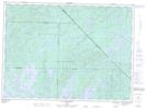
Île Jacey is a Island located in Réservoir-Dozois; Vallée-de-l'Or, Quebec and has an elevation of 364 meters.
- Latitude: 47° 34' 57'' North (decimal: 47.5825)
- Longitude: 76° 39' 24'' West (decimal: -76.6566667)
- Topography Feature Category: Island
- Geographical Feature: Île / Ile
- Canadian Province/Territory: Quebec
- Elevation: 364 meters
- Location: Réservoir-Dozois; Vallée-de-l'Or
- Atlas of Canada Locator Map: Île Jacey
- GPS Coordinate Locator Map: Île Jacey Lat/Long
Île Jacey NTS Map Sheets