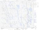
Maps showing Lac Jacqui, Rivière-Mouchalagane; Caniapiscau, Quebec
Lac Jacqui is a Lake located in Rivière-Mouchalagane; Caniapiscau, Quebec and has an elevation of 552 meters.
- Latitude: 52° 20' 9'' North (decimal: 52.3358333)
- Longitude: 67° 43' 48'' West (decimal: -67.73)
- Topography Feature Category: Lake
- Geographical Feature: Lac
- Canadian Province/Territory: Quebec
- Elevation: 552 meters
- Location: Rivière-Mouchalagane; Caniapiscau
- Atlas of Canada Locator Map: Lac Jacqui
- GPS Coordinate Locator Map: Lac Jacqui Lat/Long
Lac Jacqui NTS Map Sheets