Maps showing Lac Jans, Rivière-Mistassini; Maria-Chapdelaine, Quebec
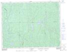
Lac Jans is a Lake located in Rivière-Mistassini; Maria-Chapdelaine, Quebec and has an elevation of 360 meters.
- Latitude: 49° 39' 42'' North (decimal: 49.6616667)
- Longitude: 73° 27' 43'' West (decimal: -73.4619444)
- Topography Feature Category: Lake
- Geographical Feature: Lac
- Canadian Province/Territory: Quebec
- Elevation: 360 meters
- Location: Rivière-Mistassini; Maria-Chapdelaine
- Atlas of Canada Locator Map: Lac Jans
- GPS Coordinate Locator Map: Lac Jans Lat/Long
Lac Jans NTS Map Sheets