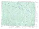
Maps showing Rivière Johnny-Gilbert, Lac-Ministuk; Le Fjord-du-Saguenay, Quebec
Rivière Johnny-Gilbert is a River located in Lac-Ministuk; Le Fjord-du-Saguenay, Quebec.
- Latitude: 48° 5' 50'' North (decimal: 48.0972643)
- Longitude: 71° 14' 51'' West (decimal: -71.2475968)
- Topography Feature Category: River
- Geographical Feature: Rivière
- Canadian Province/Territory: Quebec
- Location: Lac-Ministuk; Le Fjord-du-Saguenay
- GPS Coordinate Locator Map: Rivière Johnny-Gilbert Lat/Long
Rivière Johnny-Gilbert NTS Map Sheets