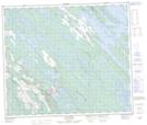
Maps showing Lac Juin, Schefferville; Caniapiscau, Quebec
Lac Juin is a Lake located in Schefferville; Caniapiscau, Quebec and has an elevation of 495 meters.
- Latitude: 54° 49' 29'' North (decimal: 54.8248345)
- Longitude: 66° 50' 27'' West (decimal: -66.8409294)
- Topography Feature Category: Lake
- Geographical Feature: Lac
- Canadian Province/Territory: Quebec
- Elevation: 495 meters
- Location: Schefferville; Caniapiscau
- Atlas of Canada Locator Map: Lac Juin
- GPS Coordinate Locator Map: Lac Juin Lat/Long
Lac Juin NTS Map Sheets