Canada Topographic Maps

Rivière Jupiter Topo Maps

Topography maps and Latitude/Longitude Location

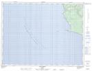
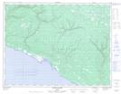
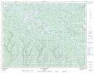
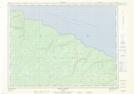
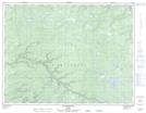
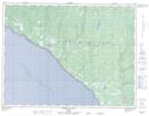
Maps showing Rivière Jupiter, L'Île-d'Anticosti; Minganie, Quebec

Rivière Jupiter is a River located in L'Île-d'Anticosti; Minganie, Quebec and has an elevation of 40 meters.

  • Latitude: 49° 28' 34'' North   (decimal: 49.4761783)
  • Longitude: 63° 35' 35'' West   (decimal: -63.5929202)
  • Topography Feature Category: River
  • Geographical Feature: Rivière
  • Canadian Province/Territory: Quebec
  • Elevation: 40 meters
  • Location: L'Île-d'Anticosti; Minganie
  • Atlas of Canada Locator Map: Rivière Jupiter
  • GPS Coordinate Locator Map: Rivière Jupiter Lat/Long

Rivière Jupiter NTS Map Sheets

012E05 Anse Gibbons Topographic Map at 1:50,000 scale

012E06 Riviere Galiote Topographic Map at 1:50,000 scale

012E07 Lac Rainsford Topographic Map at 1:50,000 scale

012E10 Pointe Carleton Topographic Map at 1:50,000 scale

012E11 Lac Wickenden Topographic Map at 1:50,000 scale

012E12 Riviere Au Fusil Topographic Map at 1:50,000 scale

012E Ile D'Anticosti Topographic Map at 1:250,000 scale

 
Buy Topographic Maps DVD
Newsletter Sign-up

Yes, I want to receive map store discounts.


Bookmark and Share