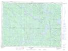
Maps showing Ruisseau Kennedy, Lac-Nilgaut; Pontiac, Quebec
Ruisseau Kennedy is a River located in Lac-Nilgaut; Pontiac, Quebec and has an elevation of 365 meters.
- Latitude: 46° 48' 10'' North (decimal: 46.8028375)
- Longitude: 76° 56' 38'' West (decimal: -76.9438780)
- Topography Feature Category: River
- Geographical Feature: Ruisseau
- Canadian Province/Territory: Quebec
- Elevation: 365 meters
- Location: Lac-Nilgaut; Pontiac
- Atlas of Canada Locator Map: Ruisseau Kennedy
- GPS Coordinate Locator Map: Ruisseau Kennedy Lat/Long
Ruisseau Kennedy NTS Map Sheets