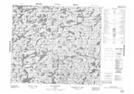
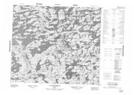
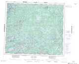
Maps showing Lac Kenogamisi, Rivière-Koksoak; Kativik, Quebec
Lac Kenogamisi is a Lake located in Rivière-Koksoak; Kativik, Quebec.
- Latitude: 55° 10' 24'' North (decimal: 55.1733333)
- Longitude: 71° 3' 58'' West (decimal: -71.0661111)
- Topography Feature Category: Lake
- Geographical Feature: Lac
- Canadian Province/Territory: Quebec
- Location: Rivière-Koksoak; Kativik
- GPS Coordinate Locator Map: Lac Kenogamisi Lat/Long
Lac Kenogamisi NTS Map Sheets