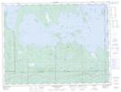
Maps showing Île Kénosha, Clerval; Abitibi-Ouest, Quebec
Île Kénosha is a Island located in Clerval; Abitibi-Ouest, Quebec and has an elevation of 274 meters.
- Latitude: 48° 43' 21'' North (decimal: 48.7225928)
- Longitude: 79° 31' 0'' West (decimal: -79.5167766)
- Topography Feature Category: Island
- Geographical Feature: Île / Ile
- Canadian Province/Territory: Quebec
- Elevation: 274 meters
- Location: Clerval; Abitibi-Ouest
- Atlas of Canada Locator Map: Île Kénosha
- GPS Coordinate Locator Map: Île Kénosha Lat/Long
Île Kénosha NTS Map Sheets