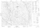
Maps showing Lac Kerdelhué, Petit-Mécatina; Minganie, Quebec
Lac Kerdelhué is a Lake located in Petit-Mécatina; Minganie, Quebec and has an elevation of 444 meters.
- Latitude: 51° 41' 36'' North (decimal: 51.6934034)
- Longitude: 61° 43' 50'' West (decimal: -61.7306185)
- Topography Feature Category: Lake
- Geographical Feature: Lac
- Canadian Province/Territory: Quebec
- Elevation: 444 meters
- Location: Petit-Mécatina; Minganie
- Atlas of Canada Locator Map: Lac Kerdelhué
- GPS Coordinate Locator Map: Lac Kerdelhué Lat/Long
Lac Kerdelhué NTS Map Sheets