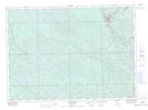
Maps showing Ketchen, Témiscaming; Témiscamingue, Quebec
Ketchen is a Unincorporated area located in Témiscaming; Témiscamingue, Quebec.
- Latitude: 46° 40' 58'' North (decimal: 46.6827778)
- Longitude: 79° 4' 33'' West (decimal: -79.0758333)
- Topography Feature Category: Unincorporated area
- Geographical Feature: Hameau
- Canadian Province/Territory: Quebec
- Location: Témiscaming; Témiscamingue
- Atlas of Canada Locator Map: Ketchen
- GPS Coordinate Locator Map: Ketchen Lat/Long
Ketchen NTS Map Sheets