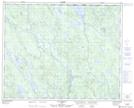
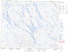
Maps showing Rivière Kokumesh, Lac-Jérôme; Minganie, Quebec
Rivière Kokumesh is a River located in Lac-Jérôme; Minganie, Quebec.
- Latitude: 51° 54' 22'' North (decimal: 51.9061716)
- Longitude: 63° 49' 0'' West (decimal: -63.8167460)
- Topography Feature Category: River
- Geographical Feature: Rivière
- Canadian Province/Territory: Quebec
- Location: Lac-Jérôme; Minganie
- GPS Coordinate Locator Map: Rivière Kokumesh Lat/Long
Rivière Kokumesh NTS Map Sheets