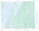
Maps showing Archipel des Koukoudjés, Baie-James; Jamésie, Quebec
Archipel des Koukoudjés is a Island located in Baie-James; Jamésie, Quebec and has an elevation of 363 meters.
- Latitude: 50° 35' 39'' North (decimal: 50.5941667)
- Longitude: 73° 58' 25'' West (decimal: -73.9736111)
- Topography Feature Category: Island
- Geographical Feature: Archipel
- Canadian Province/Territory: Quebec
- Elevation: 363 meters
- Location: Baie-James; Jamésie
- Atlas of Canada Locator Map: Archipel des Koukoudjés
- GPS Coordinate Locator Map: Archipel des Koukoudjés Lat/Long
Archipel des Koukoudjés NTS Map Sheets