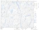
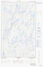
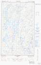
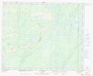
Maps showing Rivière Labadie, Rivière-Mouchalagane; Caniapiscau, Quebec
Rivière Labadie is a River located in Rivière-Mouchalagane; Caniapiscau, Quebec and has an elevation of 601 meters.
- Latitude: 52° 30' 21'' North (decimal: 52.5058333)
- Longitude: 69° 47' 22'' West (decimal: -69.7894444)
- Topography Feature Category: River
- Geographical Feature: Rivière
- Canadian Province/Territory: Quebec
- Elevation: 601 meters
- Location: Rivière-Mouchalagane; Caniapiscau
- Atlas of Canada Locator Map: Rivière Labadie
- GPS Coordinate Locator Map: Rivière Labadie Lat/Long
Rivière Labadie NTS Map Sheets