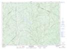
Maps showing Rivière Lachaine, Saint-Pierre-de-Lamy; Témiscouata, Quebec
Rivière Lachaine is a River located in Saint-Pierre-de-Lamy; Témiscouata, Quebec and has an elevation of 281 meters.
- Latitude: 47° 44' 43'' North (decimal: 47.7452981)
- Longitude: 68° 59' 19'' West (decimal: -68.9886395)
- Topography Feature Category: River
- Geographical Feature: Rivière
- Canadian Province/Territory: Quebec
- Elevation: 281 meters
- Location: Saint-Pierre-de-Lamy; Témiscouata
- Atlas of Canada Locator Map: Rivière Lachaine
- GPS Coordinate Locator Map: Rivière Lachaine Lat/Long
Rivière Lachaine NTS Map Sheets