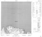
Maps showing Cap La Lande, Baie-d'Hudson; Kativik, Quebec
Cap La Lande is a Cape located in Baie-d'Hudson; Kativik, Quebec.
- Latitude: 62° 17' 4'' North (decimal: 62.2844737)
- Longitude: 75° 8' 20'' West (decimal: -75.1389228)
- Topography Feature Category: Cape
- Geographical Feature: Cap
- Canadian Province/Territory: Quebec
- Location: Baie-d'Hudson; Kativik
- Atlas of Canada Locator Map: Cap La Lande
- GPS Coordinate Locator Map: Cap La Lande Lat/Long
Cap La Lande NTS Map Sheets