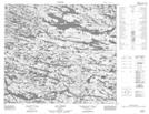
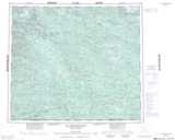
Maps showing Lac Lamain, Baie-d'Hudson; Kativik, Quebec
Lac Lamain is a Lake located in Baie-d'Hudson; Kativik, Quebec and has an elevation of 238 meters.
- Latitude: 55° 54' 13'' North (decimal: 55.9036111)
- Longitude: 75° 6' 14'' West (decimal: -75.1038889)
- Topography Feature Category: Lake
- Geographical Feature: Lac
- Canadian Province/Territory: Quebec
- Elevation: 238 meters
- Location: Baie-d'Hudson; Kativik
- Atlas of Canada Locator Map: Lac Lamain
- GPS Coordinate Locator Map: Lac Lamain Lat/Long
Lac Lamain NTS Map Sheets