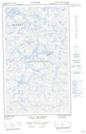
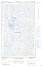
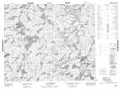
Maps showing Lac La Milleraye, Caniapiscau; Caniapiscau, Quebec
Lac La Milleraye is a Lake located in Caniapiscau; Caniapiscau, Quebec and has an elevation of 576 meters.
- Latitude: 54° 9' 4'' North (decimal: 54.1511111)
- Longitude: 67° 58' 31'' West (decimal: -67.9752778)
- Topography Feature Category: Lake
- Geographical Feature: Lac
- Canadian Province/Territory: Quebec
- Elevation: 576 meters
- Location: Caniapiscau; Caniapiscau
- Atlas of Canada Locator Map: Lac La Milleraye
- GPS Coordinate Locator Map: Lac La Milleraye Lat/Long
Lac La Milleraye NTS Map Sheets