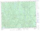
Maps showing Dépôt-La Moelle, Lac-Ashuapmushuan; Le Domaine-du-Roy, Quebec
Dépôt-La Moelle is a Natural resources site located in Lac-Ashuapmushuan; Le Domaine-du-Roy, Quebec.
- Latitude: 48° 21' 50'' North (decimal: 48.3638888)
- Longitude: 72° 39' 21'' West (decimal: -72.6558333)
- Topography Feature Category: Natural resources site
- Geographical Feature: Dépôt forestier
- Canadian Province/Territory: Quebec
- Location: Lac-Ashuapmushuan; Le Domaine-du-Roy
- Atlas of Canada Locator Map: Dépôt-La Moelle
- GPS Coordinate Locator Map: Dépôt-La Moelle Lat/Long
Dépôt-La Moelle NTS Map Sheets