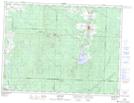
Maps showing Rivière Landrienne, Amos; Abitibi, Quebec
Rivière Landrienne is a River located in Amos; Abitibi, Quebec and has an elevation of 324 meters.
- Latitude: 48° 30' 58'' North (decimal: 48.5162020)
- Longitude: 78° 5' 59'' West (decimal: -78.0997673)
- Topography Feature Category: River
- Geographical Feature: Rivière
- Canadian Province/Territory: Quebec
- Elevation: 324 meters
- Location: Amos; Abitibi
- Atlas of Canada Locator Map: Rivière Landrienne
- GPS Coordinate Locator Map: Rivière Landrienne Lat/Long
Rivière Landrienne NTS Map Sheets