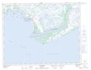
Maps showing Baie Landry, Aguanish; Minganie, Quebec
Baie Landry is a Bay located in Aguanish; Minganie, Quebec and has an elevation of 0 meters.
- Latitude: 50° 13' 6'' North (decimal: 50.2184056)
- Longitude: 61° 54' 56'' West (decimal: -61.9156502)
- Topography Feature Category: Bay
- Geographical Feature: Baie
- Canadian Province/Territory: Quebec
- Elevation: 0 meters
- Location: Aguanish; Minganie
- Atlas of Canada Locator Map: Baie Landry
- GPS Coordinate Locator Map: Baie Landry Lat/Long
Baie Landry NTS Map Sheets