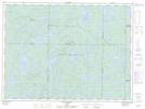
Maps showing Langlade, Senneterre; Vallée-de-l'Or, Quebec
Langlade is a Unincorporated area located in Senneterre; Vallée-de-l'Or, Quebec and has an elevation of 451 meters.
- Latitude: 48° 13' 50'' North (decimal: 48.2305556)
- Longitude: 75° 58' 25'' West (decimal: -75.9736111)
- Topography Feature Category: Unincorporated area
- Geographical Feature: Arrêt ferroviaire
- Canadian Province/Territory: Quebec
- Elevation: 451 meters
- Location: Senneterre; Vallée-de-l'Or
- Atlas of Canada Locator Map: Langlade
- GPS Coordinate Locator Map: Langlade Lat/Long
Langlade NTS Map Sheets