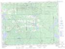
Maps showing Lac La Pause, Preissac; Abitibi, Quebec
Lac La Pause is a Lake located in Preissac; Abitibi, Quebec and has an elevation of 298 meters.
- Latitude: 48° 21' 54'' North (decimal: 48.3650894)
- Longitude: 78° 31' 38'' West (decimal: -78.5272877)
- Topography Feature Category: Lake
- Geographical Feature: Lac
- Canadian Province/Territory: Quebec
- Elevation: 298 meters
- Location: Preissac; Abitibi
- Atlas of Canada Locator Map: Lac La Pause
- GPS Coordinate Locator Map: Lac La Pause Lat/Long
Lac La Pause NTS Map Sheets