Maps showing Rivière La Ronde, Rivière-Mouchalagane; Caniapiscau, Quebec
Rivière La Ronde is a River located in Rivière-Mouchalagane; Caniapiscau, Quebec and has an elevation of 588 meters.
- Latitude: 52° 11' 41'' North (decimal: 52.1947935)
- Longitude: 66° 53' 53'' West (decimal: -66.8979960)
- Topography Feature Category: River
- Geographical Feature: Rivière
- Canadian Province/Territory: Quebec
- Elevation: 588 meters
- Location: Rivière-Mouchalagane; Caniapiscau
- Atlas of Canada Locator Map: Rivière La Ronde
- GPS Coordinate Locator Map: Rivière La Ronde Lat/Long
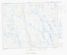
Rivière La Ronde NTS Map Sheets