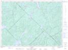
Maps showing RuisseauLascelles, Sainte-Anne-du-Lac; Antoine-Labelle, Quebec
RuisseauLascelles is a River located in Sainte-Anne-du-Lac; Antoine-Labelle, Quebec.
- Latitude: 46° 51' 53'' North (decimal: 46.8647222)
- Longitude: 75° 17' 31'' West (decimal: -75.2919444)
- Topography Feature Category: River
- Geographical Feature: Ruisseau
- Canadian Province/Territory: Quebec
- Location: Sainte-Anne-du-Lac; Antoine-Labelle
- Atlas of Canada Locator Map: RuisseauLascelles
- GPS Coordinate Locator Map: RuisseauLascelles Lat/Long
RuisseauLascelles NTS Map Sheets