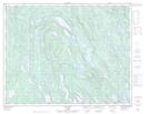
Maps showing Lac Lebrun, Lac-Jérôme; Minganie, Quebec
Lac Lebrun is a Lake located in Lac-Jérôme; Minganie, Quebec and has an elevation of 414 meters.
- Latitude: 50° 55' 4'' North (decimal: 50.9178447)
- Longitude: 62° 54' 22'' West (decimal: -62.9062177)
- Topography Feature Category: Lake
- Geographical Feature: Lac
- Canadian Province/Territory: Quebec
- Elevation: 414 meters
- Location: Lac-Jérôme; Minganie
- Atlas of Canada Locator Map: Lac Lebrun
- GPS Coordinate Locator Map: Lac Lebrun Lat/Long
Lac Lebrun NTS Map Sheets