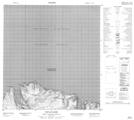
Maps showing Cap Le Compte, Baie-d'Hudson; Kativik, Quebec
Cap Le Compte is a Cape located in Baie-d'Hudson; Kativik, Quebec.
- Latitude: 62° 18' 39'' North (decimal: 62.3108602)
- Longitude: 75° 23' 25'' West (decimal: -75.3903248)
- Topography Feature Category: Cape
- Geographical Feature: Cap
- Canadian Province/Territory: Quebec
- Location: Baie-d'Hudson; Kativik
- Atlas of Canada Locator Map: Cap Le Compte
- GPS Coordinate Locator Map: Cap Le Compte Lat/Long
Cap Le Compte NTS Map Sheets