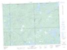
Maps showing Lac Ledah, Rouyn-Noranda; Rouyn-Noranda, Quebec
Lac Ledah is a Lake located in Rouyn-Noranda; Rouyn-Noranda, Quebec and has an elevation of 358 meters.
- Latitude: 47° 58' 33'' North (decimal: 47.9758333)
- Longitude: 78° 17' 6'' West (decimal: -78.285)
- Topography Feature Category: Lake
- Geographical Feature: Lac
- Canadian Province/Territory: Quebec
- Elevation: 358 meters
- Location: Rouyn-Noranda; Rouyn-Noranda
- Atlas of Canada Locator Map: Lac Ledah
- GPS Coordinate Locator Map: Lac Ledah Lat/Long
Lac Ledah NTS Map Sheets