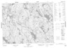
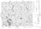
Maps showing Lac Le Doré, Petit-Mécatina; Minganie, Quebec
Lac Le Doré is a Lake located in Petit-Mécatina; Minganie, Quebec and has an elevation of 317 meters.
- Latitude: 51° 16' 48'' North (decimal: 51.2800746)
- Longitude: 61° 22' 28'' West (decimal: -61.3745017)
- Topography Feature Category: Lake
- Geographical Feature: Lac
- Canadian Province/Territory: Quebec
- Elevation: 317 meters
- Location: Petit-Mécatina; Minganie
- Atlas of Canada Locator Map: Lac Le Doré
- GPS Coordinate Locator Map: Lac Le Doré Lat/Long
Lac Le Doré NTS Map Sheets