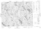
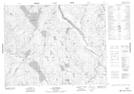
Maps showing Rivière Le Doré, Petit-Mécatina; Minganie, Quebec
Rivière Le Doré is a River located in Petit-Mécatina; Minganie, Quebec and has an elevation of 212 meters.
- Latitude: 51° 5' 11'' North (decimal: 51.0864658)
- Longitude: 61° 31' 58'' West (decimal: -61.5328423)
- Topography Feature Category: River
- Geographical Feature: Rivière
- Canadian Province/Territory: Quebec
- Elevation: 212 meters
- Location: Petit-Mécatina; Minganie
- Atlas of Canada Locator Map: Rivière Le Doré
- GPS Coordinate Locator Map: Rivière Le Doré Lat/Long
Rivière Le Doré NTS Map Sheets