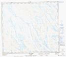
Maps showing Lac Le Fer, Rivière-Koksoak; Kativik, Quebec
Lac Le Fer is a Lake located in Rivière-Koksoak; Kativik, Quebec.
- Latitude: 55° 18' 12'' North (decimal: 55.3034375)
- Longitude: 67° 20' 23'' West (decimal: -67.3398430)
- Topography Feature Category: Lake
- Geographical Feature: Lac
- Canadian Province/Territory: Quebec
- Location: Rivière-Koksoak; Kativik
- Atlas of Canada Locator Map: Lac Le Fer
- GPS Coordinate Locator Map: Lac Le Fer Lat/Long
Lac Le Fer NTS Map Sheets