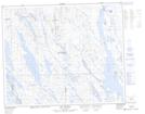
Maps showing Lac Le Gentilhomme, Rivière-Mouchalagane; Caniapiscau, Quebec
Lac Le Gentilhomme is a Lake located in Rivière-Mouchalagane; Caniapiscau, Quebec and has an elevation of 555 meters.
- Latitude: 52° 36' 29'' North (decimal: 52.6080556)
- Longitude: 66° 53' 23'' West (decimal: -66.8897221)
- Topography Feature Category: Lake
- Geographical Feature: Lac
- Canadian Province/Territory: Quebec
- Elevation: 555 meters
- Location: Rivière-Mouchalagane; Caniapiscau
- Atlas of Canada Locator Map: Lac Le Gentilhomme
- GPS Coordinate Locator Map: Lac Le Gentilhomme Lat/Long
Lac Le Gentilhomme NTS Map Sheets