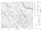
Maps showing Lac Le Marquand, Petit-Mécatina; Minganie, Quebec
Lac Le Marquand is a Lake located in Petit-Mécatina; Minganie, Quebec and has an elevation of 377 meters.
- Latitude: 51° 51' 26'' North (decimal: 51.8572859)
- Longitude: 61° 37' 43'' West (decimal: -61.6286672)
- Topography Feature Category: Lake
- Geographical Feature: Lac
- Canadian Province/Territory: Quebec
- Elevation: 377 meters
- Location: Petit-Mécatina; Minganie
- Atlas of Canada Locator Map: Lac Le Marquand
- GPS Coordinate Locator Map: Lac Le Marquand Lat/Long
Lac Le Marquand NTS Map Sheets