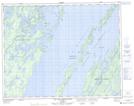
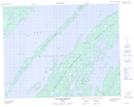
Maps showing Île Lemoine, Baie-James; Jamésie, Quebec
Île Lemoine is a Island located in Baie-James; Jamésie, Quebec and has an elevation of 393 meters.
- Latitude: 50° 58' 25'' North (decimal: 50.9736111)
- Longitude: 73° 32' 27'' West (decimal: -73.5408333)
- Topography Feature Category: Island
- Geographical Feature: Île / Ile
- Canadian Province/Territory: Quebec
- Elevation: 393 meters
- Location: Baie-James; Jamésie
- Atlas of Canada Locator Map: Île Lemoine
- GPS Coordinate Locator Map: Île Lemoine Lat/Long
Île Lemoine NTS Map Sheets