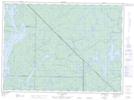
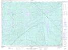
Maps showing Lac Lenôtre, Lac-Lenôtre; La Vallée-de-la-Gatineau, Quebec
Lac Lenôtre is a Lake located in Lac-Lenôtre; La Vallée-de-la-Gatineau, Quebec and has an elevation of 404 meters.
- Latitude: 47° 21' 48'' North (decimal: 47.3633333)
- Longitude: 76° 1' 41'' West (decimal: -76.0280556)
- Topography Feature Category: Lake
- Geographical Feature: Lac
- Canadian Province/Territory: Quebec
- Elevation: 404 meters
- Location: Lac-Lenôtre; La Vallée-de-la-Gatineau
- Atlas of Canada Locator Map: Lac Lenôtre
- GPS Coordinate Locator Map: Lac Lenôtre Lat/Long
Lac Lenôtre NTS Map Sheets