Maps showing Leslie-Clapham-et-Huddersfield, Otter Lake; Pontiac, Quebec
Leslie-Clapham-et-Huddersfield is a Village located in Otter Lake; Pontiac, Quebec.
- Latitude: 45° 51' 0'' North (decimal: 45.85)
- Longitude: 76° 26' 00'' West (decimal: -76.4333333)
- Topography Feature Category: Village
- Geographical Feature: Municipalité de cantons unis
- Canadian Province/Territory: Quebec
- Location: Otter Lake; Pontiac
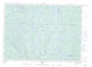
- Atlas of Canada Locator Map: Leslie-Clapham-et-Huddersfield
- GPS Coordinate Locator Map: Leslie-Clapham-et-Huddersfield Lat/Long
Leslie-Clapham-et-Huddersfield NTS Map Sheets