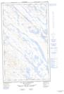
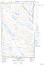
Maps showing Ruisseau Lespinay, Rivière-Koksoak; Kativik, Quebec
Ruisseau Lespinay is a River located in Rivière-Koksoak; Kativik, Quebec and has an elevation of 557 meters.
- Latitude: 55° 7' 24'' North (decimal: 55.1234383)
- Longitude: 67° 13' 10'' West (decimal: -67.2195642)
- Topography Feature Category: River
- Geographical Feature: Ruisseau
- Canadian Province/Territory: Quebec
- Elevation: 557 meters
- Location: Rivière-Koksoak; Kativik
- Atlas of Canada Locator Map: Ruisseau Lespinay
- GPS Coordinate Locator Map: Ruisseau Lespinay Lat/Long
Ruisseau Lespinay NTS Map Sheets