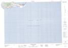
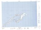
Maps showing L'Étang-du-Nord, Les Îles-de-la-Madeleine; Les Îles-de-la-Madeleine, Quebec
L'Étang-du-Nord is a Village located in Les Îles-de-la-Madeleine; Les Îles-de-la-Madeleine, Quebec and has an elevation of 13 meters.
- Latitude: 47° 22' North (decimal: 47.366667)
- Longitude: 61° 57' West (decimal: -61.9499998)
- Topography Feature Category: Village
- Geographical Feature: Municipalité
- Canadian Province/Territory: Quebec
- Elevation: 13 meters
- Location: Les Îles-de-la-Madeleine; Les Îles-de-la-Madeleine
- Atlas of Canada Locator Map: L'Étang-du-Nord
- GPS Coordinate Locator Map: L'Étang-du-Nord Lat/Long
L'Étang-du-Nord NTS Map Sheets