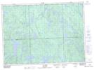
Maps showing Ruisseau Le Valon, Rivière-Kipawa; Témiscamingue, Quebec
Ruisseau Le Valon is a River located in Rivière-Kipawa; Témiscamingue, Quebec and has an elevation of 344 meters.
- Latitude: 46° 46' 13'' North (decimal: 46.7703346)
- Longitude: 78° 8' 16'' West (decimal: -78.1378185)
- Topography Feature Category: River
- Geographical Feature: Ruisseau
- Canadian Province/Territory: Quebec
- Elevation: 344 meters
- Location: Rivière-Kipawa; Témiscamingue
- Atlas of Canada Locator Map: Ruisseau Le Valon
- GPS Coordinate Locator Map: Ruisseau Le Valon Lat/Long
Ruisseau Le Valon NTS Map Sheets