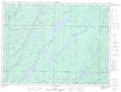
Maps showing Ruisseau Léveillé, Senneterre; Vallée-de-l'Or, Quebec
Ruisseau Léveillé is a River located in Senneterre; Vallée-de-l'Or, Quebec and has an elevation of 395 meters.
- Latitude: 48° 23' 44'' North (decimal: 48.3955556)
- Longitude: 76° 14' 33'' West (decimal: -76.2425)
- Topography Feature Category: River
- Geographical Feature: Ruisseau
- Canadian Province/Territory: Quebec
- Elevation: 395 meters
- Location: Senneterre; Vallée-de-l'Or
- Atlas of Canada Locator Map: Ruisseau Léveillé
- GPS Coordinate Locator Map: Ruisseau Léveillé Lat/Long
Ruisseau Léveillé NTS Map Sheets