Canada Topographic Maps

Lac Liégeois Topo Maps

Topography maps and Latitude/Longitude Location

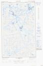
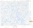
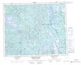
Maps showing Lac Liégeois, Caniapiscau; Caniapiscau, Quebec

Lac Liégeois is a Lake located in Caniapiscau; Caniapiscau, Quebec and has an elevation of 609 meters.

  • Latitude: 53° 15' 2'' North   (decimal: 53.2505556)
  • Longitude: 67° 32' 23'' West   (decimal: -67.5397222)
  • Topography Feature Category: Lake
  • Geographical Feature: Lac
  • Canadian Province/Territory: Quebec
  • Elevation: 609 meters
  • Location: Caniapiscau; Caniapiscau
  • Atlas of Canada Locator Map: Lac Liégeois
  • GPS Coordinate Locator Map: Lac Liégeois Lat/Long

Lac Liégeois NTS Map Sheets

023G03 Lac Montenon Topographic Map at 1:50,000 scale

023G04E Lac Opiscotiche Topographic Map at 1:50,000 scale

023G04W Lac Opiscotiche Topographic Map at 1:50,000 scale

023G05E Lac Kerbodot Topographic Map at 1:50,000 scale

023G05W Lac Kerbodot Topographic Map at 1:50,000 scale

023G06 Lac Mingre Topographic Map at 1:50,000 scale

023G Shabogamo Lake Topographic Map at 1:250,000 scale

 
Buy Topographic Maps DVD
Newsletter Sign-up

Yes, I want to receive map store discounts.


Bookmark and Share