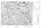
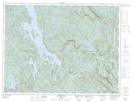
Maps showing Rivière Lionnet, Lac-au-Brochet; La Haute-Côte-Nord, Quebec
Rivière Lionnet is a River located in Lac-au-Brochet; La Haute-Côte-Nord, Quebec and has an elevation of 413 meters.
- Latitude: 49° 20' 12'' North (decimal: 49.3366667)
- Longitude: 69° 53' 36'' West (decimal: -69.8933333)
- Topography Feature Category: River
- Geographical Feature: Rivière
- Canadian Province/Territory: Quebec
- Elevation: 413 meters
- Location: Lac-au-Brochet; La Haute-Côte-Nord
- Atlas of Canada Locator Map: Rivière Lionnet
- GPS Coordinate Locator Map: Rivière Lionnet Lat/Long
Rivière Lionnet NTS Map Sheets