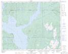
Maps showing Mont Loaf, Rivière-aux-Outardes; Manicouagan, Quebec
Mont Loaf is a Mountain located in Rivière-aux-Outardes; Manicouagan, Quebec.
- Latitude: 51° 31' 53'' North (decimal: 51.5313889)
- Longitude: 68° 4' 47'' West (decimal: -68.0797222)
- Topography Feature Category: Mountain
- Geographical Feature: Mont
- Canadian Province/Territory: Quebec
- Location: Rivière-aux-Outardes; Manicouagan
- GPS Coordinate Locator Map: Mont Loaf Lat/Long
Mont Loaf NTS Map Sheets