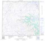
Maps showing Lac Lomier, Rivière-Koksoak; Kativik, Quebec
Lac Lomier is a Lake located in Rivière-Koksoak; Kativik, Quebec and has an elevation of 674 meters.
- Latitude: 57° 45' 38'' North (decimal: 57.7605556)
- Longitude: 63° 55' 22'' West (decimal: -63.9227778)
- Topography Feature Category: Lake
- Geographical Feature: Lac
- Canadian Province/Territory: Quebec
- Elevation: 674 meters
- Location: Rivière-Koksoak; Kativik
- Atlas of Canada Locator Map: Lac Lomier
- GPS Coordinate Locator Map: Lac Lomier Lat/Long
Lac Lomier NTS Map Sheets