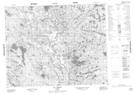
Maps showing Lac Lorens, Petit-Mécatina; Minganie, Quebec
Lac Lorens is a Lake located in Petit-Mécatina; Minganie, Quebec and has an elevation of 349 meters.
- Latitude: 51° 19' 2'' North (decimal: 51.3172900)
- Longitude: 60° 38' 30'' West (decimal: -60.6417004)
- Topography Feature Category: Lake
- Geographical Feature: Lac
- Canadian Province/Territory: Quebec
- Elevation: 349 meters
- Location: Petit-Mécatina; Minganie
- Atlas of Canada Locator Map: Lac Lorens
- GPS Coordinate Locator Map: Lac Lorens Lat/Long
Lac Lorens NTS Map Sheets