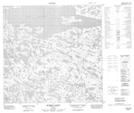
Maps showing Rivière Loubet, Rivière-Koksoak; Kativik, Quebec
Rivière Loubet is a River located in Rivière-Koksoak; Kativik, Quebec.
- Latitude: 59° 24' 27'' North (decimal: 59.4074533)
- Longitude: 74° 10' 32'' West (decimal: -74.1756172)
- Topography Feature Category: River
- Geographical Feature: Rivière
- Canadian Province/Territory: Quebec
- Location: Rivière-Koksoak; Kativik
- Atlas of Canada Locator Map: Rivière Loubet
- GPS Coordinate Locator Map: Rivière Loubet Lat/Long
Rivière Loubet NTS Map Sheets