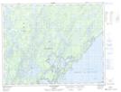
Maps showing Presqu'île Louis-Jolliet, Baie-James; Jamésie, Quebec
Presqu'île Louis-Jolliet is a Cape located in Baie-James; Jamésie, Quebec and has an elevation of 385 meters.
- Latitude: 51° 1' 30'' North (decimal: 51.025)
- Longitude: 73° 46' 15'' West (decimal: -73.7708333)
- Topography Feature Category: Cape
- Geographical Feature: Presqu'île
- Canadian Province/Territory: Quebec
- Elevation: 385 meters
- Location: Baie-James; Jamésie
- Atlas of Canada Locator Map: Presqu'île Louis-Jolliet
- GPS Coordinate Locator Map: Presqu'île Louis-Jolliet Lat/Long
Presqu'île Louis-Jolliet NTS Map Sheets