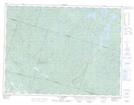
Maps showing Rivière à la Loutre, Saint-Fulgence; Le Fjord-du-Saguenay, Quebec
Rivière à la Loutre is a River located in Saint-Fulgence; Le Fjord-du-Saguenay, Quebec and has an elevation of 64 meters.
- Latitude: 48° 27' 24'' North (decimal: 48.4567076)
- Longitude: 70° 57' 21'' West (decimal: -70.9559164)
- Topography Feature Category: River
- Geographical Feature: Rivière
- Canadian Province/Territory: Quebec
- Elevation: 64 meters
- Location: Saint-Fulgence; Le Fjord-du-Saguenay
- Atlas of Canada Locator Map: Rivière à la Loutre
- GPS Coordinate Locator Map: Rivière à la Loutre Lat/Long
Rivière à la Loutre NTS Map Sheets