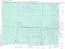
Maps showing Ruisseau Lowther, Val-d'Or; Vallée-de-l'Or, Quebec
Ruisseau Lowther is a River located in Val-d'Or; Vallée-de-l'Or, Quebec and has an elevation of 356 meters.
- Latitude: 47° 56' 24'' North (decimal: 47.94)
- Longitude: 77° 18' 59'' West (decimal: -77.3163889)
- Topography Feature Category: River
- Geographical Feature: Ruisseau
- Canadian Province/Territory: Quebec
- Elevation: 356 meters
- Location: Val-d'Or; Vallée-de-l'Or
- Atlas of Canada Locator Map: Ruisseau Lowther
- GPS Coordinate Locator Map: Ruisseau Lowther Lat/Long
Ruisseau Lowther NTS Map Sheets