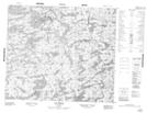
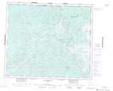
Maps showing Lac Madier, Baie-James; Jamésie, Quebec
Lac Madier is a Lake located in Baie-James; Jamésie, Quebec.
- Latitude: 54° 50' 50'' North (decimal: 54.8472222)
- Longitude: 71° 5' 26'' West (decimal: -71.0905556)
- Topography Feature Category: Lake
- Geographical Feature: Lac
- Canadian Province/Territory: Quebec
- Location: Baie-James; Jamésie
- Atlas of Canada Locator Map: Lac Madier
- GPS Coordinate Locator Map: Lac Madier Lat/Long
Lac Madier NTS Map Sheets